

IMAGE
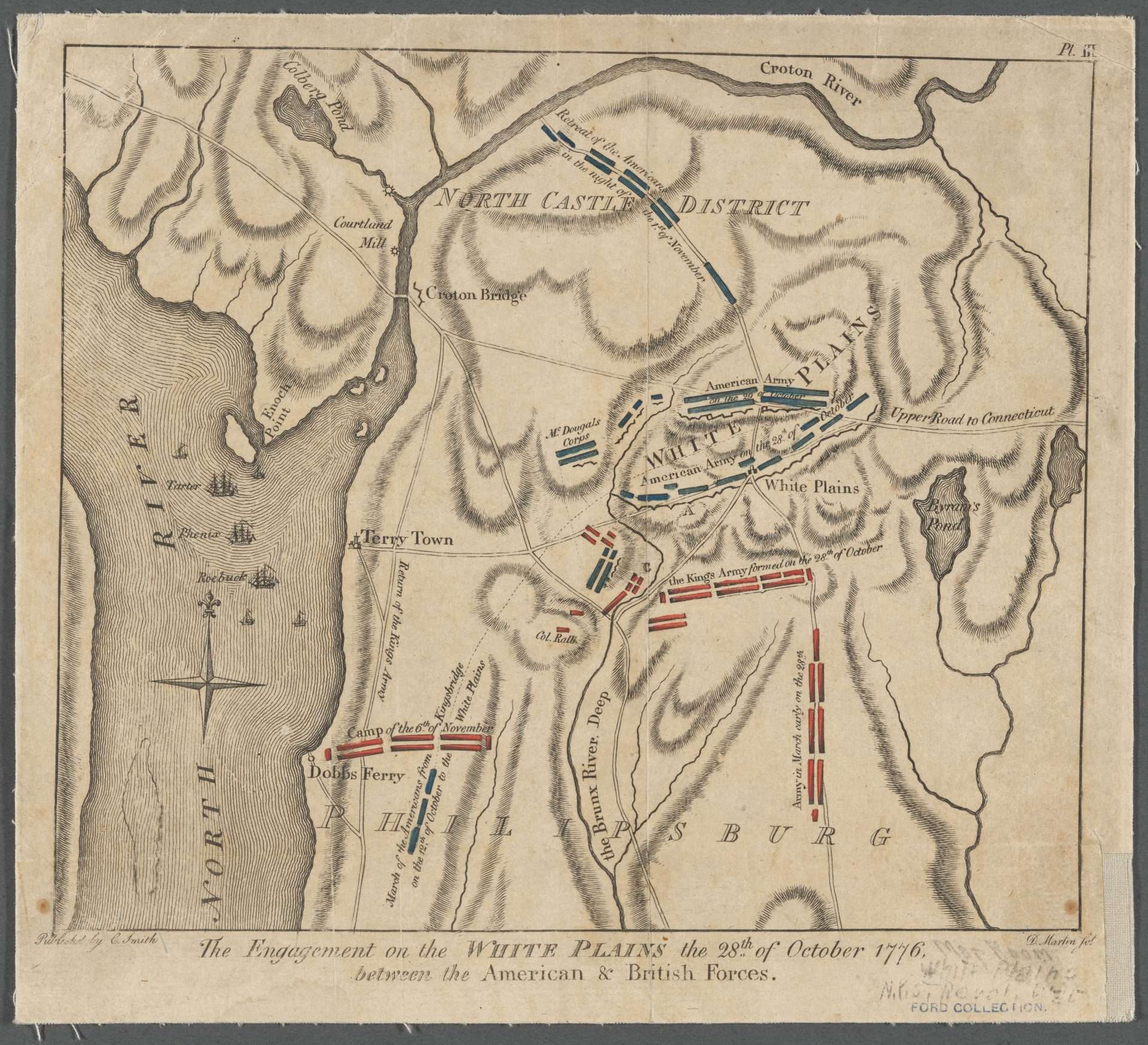
Engagement on the White Plains
This map, made for New York publisher Charles Smith’s book The American War, From 1775 to 1783, with Plans (1797), shows the position of Continental and British troops on October 28 and October 29, 1776, at White Plains, New York. Red rectangles represent the British, blue rectangles represent Continentals.The Americans were able to retreat before Howe could earn a decisive victory.


